Is anywhere safe from deadly weather? New map reveals the US states most at risk from climate crisis

New research uses extreme heat, drought, inland and coastal flooding and wildfires to rank the safety of US states.
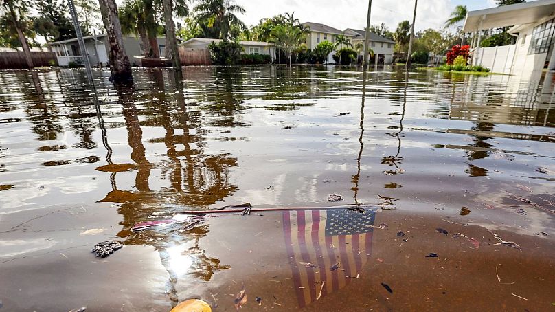
A new climate change risk index reveals the best states for Americans to escape the impacts of extreme weather like the recent devastating Category 4 Hurricane Helene.
Using data from independent scientific group Climate Central, the new risk index ranks 48 US states (Alaska and Hawaii are excluded due to lack of comparative data) according to the impact the climate crisis is likely to have on the population.
Nine out of 10 states predicted to experience the worst impacts from the climate crisis are in the American South, many of them coastal. The northeast is seen as the safest zone, with Vermont, New Hampshire and Massachusetts taking the top three spots - though nowhere escapes all climate change impacts.

Does Hurricane Helene signal the end of the so-called ‘climate haven’?
More than 200 people died during the recent 140-mile-an-hour-wind Hurricane Helene, many in Florida where the hurricane first hit land, but also across North Carolina, South Carolina, Georgia, Tennessee and Virginia.
Experts have since said that Hurricane Helene signals the end of the ‘climate haven’ - a controversial premise that there are places on Earth that are safe from the impacts of the climate crisis.
One such ‘haven’ was Asheville, North Carolina - which was hit by the recent hurricane and suffered devastating floods. Even so, there are areas with higher and lower comparative risks - depending on the climate impact being looked at.
What impacts from the climate crisis are expected in the US?
The new climate change risk index looked at factors including dangerously hot days (days with a heat index of at least 105°F or 40.6°C), increased mosquito season days, wildfire potential and percentage of the population at risk, and coastal and inland flooding.
All 48 states included in the index were expected to see an increase in extreme heat - nowhere in the continental US is seen as safe from heat. This could include more very hot days, a longer mosquito season, or a higher number of poor air quality days.
Vermont - the safest state on the list - is the only state where extreme heat is the only expected impact.
Which are the worst US states to live in due to climate change?
Seven states are expected to experience all five major climate change categories - extreme heat, drought, inland flooding, wildfires and coastal flooding.
Those states - Florida (number one in the ranking), Georgia, North Carolina, Oregon, Texas, Washington and California - also have higher-than-average Climate Change Risk Index scores.
Three in four states are expected to see their drought risk rise. Though coastal flooding is the least common climate change impact, only two of the top 10 at-risk states have no coastal flooding risk.
Where should US climate refugees head?
Those hoping to avoid the worst impacts of climate change should avoid the southeast and California and head to the northeast US, where they will find the only three states with Climate Change Risk Index scores lower than 100: Vermont, New Hampshire and Massachusetts.
The midwest is also a safer bet than the west or the southeast regions.
